FireSat AI Satellite Detects Wildfires in 20 Minutes
FireSat’s AI-powered satellite detects wildfires in 20 minutes, transforming wildfire detection and response.
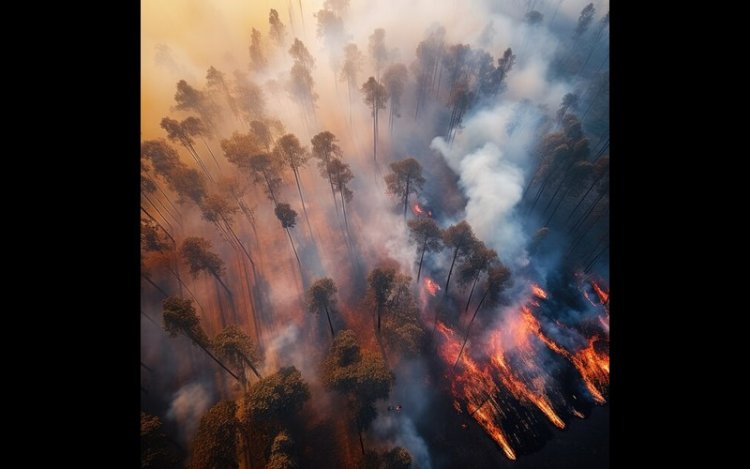
The launch of the pioneering FireSat constellation's first satellite has been a success, representing a major breakthrough in wildfire detection and response. FireSat, a pioneering initiative based on artificial intelligence, has the potential to transform the way wildfires are detected, controlled, and prevented. Designed by a collaboration among Google Research, Muon Space, Earth Fire Alliance, the Moore Foundation, and international wildfire authorities, FireSat will be capable of seeing wildfires as small as 5 meters by 5 meters—roughly a classroom size—within a mere 20 minutes after they're lit.
This next-generation satellite system has the potential to fill important gaps in existing wildfire detection systems, which tend to be based on rare, low-resolution satellite imagery. These systems may take hours to update, and authorities are then left with very little information when minutes matter. FireSat's AI-driven constellation, on the other hand, provides near real-time information, significantly improving the capacity of authorities to respond swiftly and effectively.
One of the main reasons for the development of FireSat is the personal experience of Juliet Rothenberg, who thought back to her terrifying evacuation from a California wildfire. She remembers that the only data at hand were satellite images updated every 12 hours, as the sky was covered in smoke and fire. This delay, added to the non-existent accurate data for the wildfire authorities, underlined the imperative necessity for more prompt and accurate information. Rothenberg placed high emphasis on quick detection, suggesting, "All we got was refreshed satellite imagery every 12 hours, while across the Bay Area, the sky was red and choking on smoke.". But what was even more shocking was realizing that wildfire authorities didn’t have much better data than we did.”
To ensure the success of the FireSat project, a significant investment was made by Google.org, which provided $13 million through its AI Collaborative: Wildfires initiative. This funding, alongside contributions from the Moore Foundation, played a crucial role in the satellite’s development and launch. The FireSat crew, which comprises scientists from Google Research, Muon Space, and Earth Fire Alliance, successfully deployed the satellite from Vandenberg Space Force Base. This was the starting point for a greater constellation of over 50 satellites to detect wildfires globally.
One of the greatest challenges in designing FireSat was to be able to tell a real fire from environmental "noise" or from sensor malfunctions. Co-founder Chris Van Arsdale, a member of the FireSat team, said the AI system had to learn how to distinguish between a real fire and an anomaly produced by issues such as misaligned pixels or other sensor malfunction. It took much work to refine the technology to deliver stable and accurate output.
The decision to employ satellites instead of alternative solutions like high-altitude drones was motivated by the falling cost of satellite technology and the capacity to monitor remote locations continuously. Most wildfires begin in mountainous, inaccessible areas, where it is difficult to keep a track using alternative methods. The satellite system guarantees constant observation of such areas, yielding helpful information for authorities and specialists.
The early detection capabilities of FireSat have the potential to yield significant economic and humanitarian benefits. Wildfires are a leading cause of loss of life and property damage, particularly in areas prone to these devastating events. By enabling faster response times and providing more accurate data, FireSat can help mitigate the impact of wildfires, reducing the destruction they cause. The system also provides significant environmental advantages, as it can be used to save valuable ecosystems and biodiversity that are frequently threatened by fire.
Aside from its application to emergency response, FireSat can also provide support in the global fight against climate change. The information gathered by the satellites will be useful in producing a global historical record of fire activity and will give important insights into long-term patterns and trends of wildfires. This will be useful for climate scientists who are researching how climate change influences the frequency and intensity of wildfires. The capacity to identify and control wildfires more efficiently can lower overall greenhouse gas emissions related to them. As Juliet Rothenberg said, "FireSat is more than an emergency tool. It's also a fantastic tool for mitigating greenhouse gas emissions. It's really lovely that the constellation helps to mitigate climate change—while responding to it."
The FireSat constellation is a big advancement in the battle against wildfires and climate change. By marrying advanced satellite technology with AI, FireSat stands to enhance wildfire detection and management, having the potential to save lives, preserve ecosystems, and minimize the economic cost of these destructive incidents. As the constellation expands and more satellites are deployed, FireSat can change wildfire monitoring and response for the better around the world, having a substantial effect on both the environment and communities exposed to wildfire risks.
What's Your Reaction?