A new study finds that marine cloud brightening, a proposed geoengineering technique, could significantly weaken El Niño, potentially affecting weather patterns including India's monsoon
A new study out of UC Santa Barbara has put fresh weight behind an idea that's been floating around climate circles for years: brighten some clouds over the eastern Pacific, and you could reshape El Niño so drastically that the ripples reach global weather, agriculture, entire ecosystems. For India, that's not some far-off academic worry. Three-quarters of the country's annual rainfall shows up in a single monsoon season. This is close to the most important number on the calendar.
The research comes from UCSB scientists writing in the journal Earth's Future, and it lands at an awkward moment. Emissions keep climbing. Warming targets keep slipping further out of reach. Governments and investors have started taking geoengineering — deliberately messing with the climate to cool it down — a lot more seriously than they used to. The team's message isn't that these ideas are reckless or evil. It's quieter than that, and honestly more unsettling: two methods can cool the planet by the exact same amount and still do completely different things to the weather billions of people actually farm and live by.
For a country like India, that's not a technicality. It's the gap between a normal monsoon and a broken one.
What they actually tested
Two "solar geoengineering" strategies got compared here, both chasing the same basic goal — bounce a bit more sunlight back into space before it heats the surface. But they go about it in totally different ways.
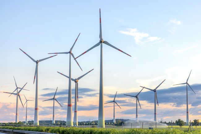
Marine cloud brightening (MCB) works low and local. Ships spray a fine mist of sea-salt particles less than two kilometres above the ocean, seeding clouds with more, smaller droplets. The clouds turn whiter, more reflective — basically a brighter sunshade parked over the sea. Stratospheric aerosol injection (SAI), on the other hand, goes high — sulfate particles released far up in the stratosphere, drifting into a thin, even veil wrapped around the entire globe. Think of it as a planet-wide dimmer switch, similar to what a big volcanic eruption does naturally for a year or two.
The team ran both through climate models and watched what happened to ENSO — the El Niño–Southern Oscillation.
Here's where it gets uncomfortable. Deploy MCB over the subtropical eastern Pacific — a spot researchers like precisely because it cools so efficiently there — and El Niño doesn't just wobble. It collapses. About 61% of its strength, gone. Two-thirds of its natural variability, just... drained away.
Speed is what really rattled the researchers. Lead author Chen Xing, a doctoral student at UCSB's Bren School, has said the team expected some effect, sure — but nothing close to that scale. His advisor, Associate Professor Samantha Stevenson, put it about as plainly as a scientist can: the climate "just does not naturally drop 60% in 10 years," she said, not even under runaway global warming.
SAI, tested the exact same way? Barely a flicker. Almost nothing.
Same goal. Same physics, more or less. Wildly different consequences for one of the planet's most important climate systems.
Why India should care
You need to understand what ENSO actually does before any of this lands, and few countries feel it more directly than India does.
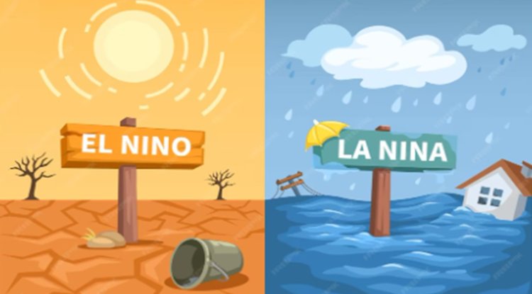
ENSO is a natural see-saw — warm water and pressure sloshing back and forth across the tropical Pacific, flipping every two to seven years. El Niño is when the warm water heads east toward the Americas. La Niña is when it stays put in the west. It's born in the Pacific, but its reach doesn't stop there — it stretches all the way to the Indian subcontinent.
And it runs straight through the monsoon. El Niño years tend to weaken it; La Niña years tend to strengthen it. That's not some minor footnote — it's the entire foundation of India's agricultural calendar:
- The southwest monsoon delivers roughly three-quarters of India's annual rainfall, packed into just four months (June–September).
- More than half of India's net sown area is rain-fed. No irrigation to fall back on if the rains disappoint.
- Agriculture still employs something like half of India's workforce, and contributes close to a sixth of GDP.
The history backs this up. Of the 16 El Niño years since 1950, seven brought a below-normal monsoon. The most recent one is barely three years old — 2023 was an El Niño year, and India's monsoon closed about 6% below its long-period average, the first shortfall in four years, with roughly 31% of districts (221 out of 718) left short of rain.
Sit with those two facts side by side for a second. El Niño already decides whether tens of millions of Indian farmers have a good year or a genuinely rough one. And here's a proposed climate "fix" that, in a model at least, suppressed the whole system by 61%.
One honest caveat: the UCSB study didn't model the Indian monsoon directly, and the researchers are careful not to overreach on that point. But ENSO is the dial the monsoon is wired to. Turn that dial down — even with the best of intentions — and you're reaching into the machinery behind India's rainfall, whether anyone meant to or not.
How a few brighter clouds ripple that far
It's a fair question. Why would spraying salt mist over one patch of ocean cascade into a Pacific-wide collapse? The chain, once traced out, is oddly simple:
- Brighter clouds reflect more sunlight, so the ocean surface underneath cools.
- Smaller droplets in those clouds don't merge into rain as easily — so it dries out too.
- That cooler, drier air drifts toward the central Pacific, where less water evaporates off a cooler surface.
- Atmospheric circulation weakens as the evaporation engine loses steam.
- Equatorial winds strengthen in response, dragging more cold water up from the deep.
- The surface cools even further — and the loop feeds itself.
Six small steps. Together, they're enough to gut El Niño almost entirely.
SAI never got caught in this loop, probably because of simple geometry — its cooling spreads evenly across the whole globe instead of concentrating on one climate-sensitive patch of ocean. Diffuse instead of targeted. That's likely the whole reason it left ENSO alone.
What's Your Reaction?