

A new AI tool called SenseNet uses deep denoising to remove cloud cover from optical satellite imagery, improving clarity and data quality for climate, agriculture, and infrastructure monitoring.
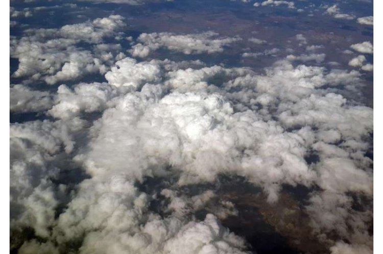
A hybrid artificial intelligence (AI) system developed by researchers can remove clouds from satellite images. This breakthrough could significantly improve the quality and reliability of Earth observation data used in climate monitoring, agriculture, and infrastructure planning.
Most optical satellite images — the kind that show landscapes in visible light — suffer from cloud cover. Thick clouds can completely block the view of the ground, while thinner haze and shadows blur details. Scientists have long battled this problem because cloudy pixels reduce the usefulness of data collected by remote sensing. This new system, nicknamed SenseNet, treats clouds as a form of structured noise and uses advanced computational techniques to “clean” images with greater accuracy than earlier methods.
Worst Problem First: Clouds Block Earth Observation
Satellite images are central to modern environmental monitoring. Governments, researchers and private organisations use them to track deforestation, assess crop health, map infrastructure and monitor water resources. However, most optical satellite imagery is affected by cloud cover to varying degrees. Traditional cloud-removal techniques, including atmospheric light modelling and multi-temporal image comparisons, have limitations. They often perform poorly when clouds are dense, widespread or persistent, particularly in tropical regions where overcast conditions are frequent.
Machine-learning methods were developed to improve upon physical models by identifying patterns in large datasets. However, many of these systems rely on clean reference images for training. When unobstructed reference data is unavailable, reconstruction accuracy declines, often resulting in blurred or incomplete representations of the Earth’s surface beneath cloud cover.
What SenseNet Does Differently
SenseNet addresses the problem by treating cloud and haze interference as structured image noise. Rather than depending on atmospheric correction formulas or comparisons across multiple time frames, it applies a deep denoising model designed to separate cloud-related noise from underlying surface information. This enables the reconstruction of ground features from partially obscured imagery.
The system incorporates a hybrid Coyote Fox Optimisation algorithm, inspired by cooperative behavioural patterns observed in animals. This optimisation method adjusts internal parameters during training to enhance model convergence and reduce the likelihood of stagnation in suboptimal solutions. In testing, the system improved signal-to-noise ratios by more than 2 decibels, representing an approximately 60 per cent increase over several existing denoising methods. It also reduced residual reconstruction errors in processed satellite images.
Why This Matters
Higher-quality satellite imagery supports a range of applications. In agriculture, improved image clarity assists in identifying crop boundaries, evaluating plant health and estimating yields. Urban planners and engineers use satellite data to map roads, buildings and water systems. Environmental monitoring agencies rely on such imagery to track deforestation, flooding and land-use change.
Improved cloud removal may also reduce observational gaps in regions with persistent cloud cover, including tropical forests and monsoon-affected areas. In these regions, repeated satellite passes frequently capture incomplete data due to overcast conditions. Increasing the proportion of usable imagery could strengthen data continuity for climate monitoring and disaster response systems.
What’s Next
The study describing SenseNet was published in the International Journal of Bio-Inspired Computation. Cloud-removal research continues to evolve, with parallel development of diffusion-based image reconstruction models and self-supervised learning approaches. Further evaluation and integration into operational Earth observation systems will determine its applicability in real-world satellite data processing workflows.
What's Your Reaction?