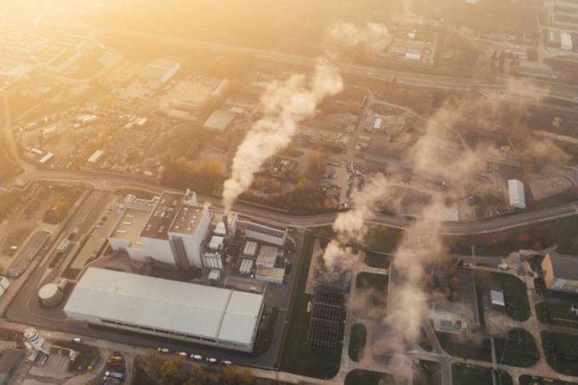
A new study reports that weather models used to predict air pollution may produce inaccurate forecasts in heavily irrigated regions because they often fail to account for irrigation’s cooling and moisture effects.
Weather models used to predict air pollution may produce inaccurate results in regions with extensive irrigation, according to a new study examining how land surface processes influence atmospheric conditions. Researchers found that failing to account for irrigation in weather simulations can distort heat and moisture estimates, which in turn affects air quality forecasts.
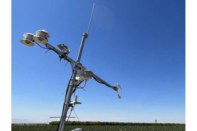
The research evaluated a commonly used land surface component of the Weather Research and Forecasting (WRF) model, which is widely applied by air quality agencies in the United States. Scientists compared model simulations with real-world measurements collected over a year from monitoring towers in California’s San Joaquin Valley and the Mid-Atlantic region.
Their analysis found that the model produced large errors in heavily irrigated agricultural regions because irrigation was not explicitly represented in the system.
Irrigated farmland can appear too hot and dry in models
In California’s San Joaquin Valley—one of the most heavily irrigated agricultural regions in the United States—the model misrepresented surface conditions.
The study found that the system overestimated the amount of heat moving from the land surface into the atmosphere by about 260 watts per square metre during summer daylight hours, a difference of about 274%. At the same time, it underestimated the cooling effect caused by evaporation by about 200 watts per square metre.
These errors occur because irrigation adds water to the soil, which increases evaporation and cools the surface. When irrigation is not included in weather models, simulations represent the land surface as hotter and drier than it actually is.
Why this matters for pollution forecasts
Errors in surface heat estimates influence how atmospheric conditions are represented in air quality simulations.
If a model predicts higher heat levels than those observed, it can simulate a deeper atmospheric boundary layer—the lowest part of the atmosphere where pollutants mix. A deeper layer allows pollutants to disperse more in the simulation, which can lead to lower estimated pollution concentrations near the surface.
As a result, pollution forecasts based on such simulations may show lower pollution levels than those observed, particularly in agricultural regions with widespread irrigation.
Differences between agricultural and urban regions
Researchers also evaluated model performance in the Mid-Atlantic region, which includes urban areas and vegetation but has far less irrigated farmland.
In that region, the model produced smaller errors. It slightly overestimated both heating and evaporation and simulated somewhat higher temperatures over urban areas and slightly wetter conditions over vegetated land. Overall, the representation of land–atmosphere exchanges was closer to observational measurements than in the irrigated California region.
The contrast between the two regions shows that irrigation practices influence local weather processes.
Surface processes also affect wind and atmospheric mixing
The study also found that the model overestimated the effect of land surfaces on slowing and mixing wind during daytime hours.
These processes influence how air moves and how pollutants spread through the lower atmosphere. If these interactions are misrepresented, models may miscalculate the transport of pollutants, affecting forecasts for fine particulate matter and ozone concentrations.
Accurate representation of land surface conditions is therefore important for both weather prediction and air quality monitoring.
Improving models by including irrigation data
Researchers state that including irrigation in weather models could improve air quality simulations in agricultural regions. One possible approach involves using satellite observations of vegetation and soil moisture to estimate irrigation effects.
Scientists are also testing whether existing modelling tools that track land surface moisture can reduce the heat flux errors identified in the study.
Before such updates are used in operational forecasting systems, researchers note that further testing is required to determine whether improved land surface representation leads to more accurate air quality predictions and whether these changes can be implemented in systems used by state agencies.
Implications for environmental forecasting
Air quality models are used by governments and environmental agencies to guide pollution control strategies and issue public health advisories. If weather simulations contain systematic errors, forecasts may not accurately represent real-world conditions.
The findings indicate that land use practices such as irrigation influence atmospheric processes and should be considered in weather and air quality models. Accurate representation of these factors is important for improving environmental forecasting.
What's Your Reaction?