A new study combines data from multiple existing sources to create a detailed and constantly updated picture of vehicle emissions.

Researchers at Massachusetts Institute of Technology have developed a way to measure vehicle pollution almost in real time by combining data from traffic cameras, mobile phone movement, and known vehicle emission levels. The study, carried out in New York City, shows how cities can get a much clearer picture of which roads, junctions, and areas are producing the most pollution at different times of the day.
The researchers used footage from 331 traffic cameras across Manhattan along with anonymous location data from more than 1.75 million mobile phones. By using computer vision, they were able to identify different types of vehicles, such as cars, buses, and trucks, without collecting licence plate numbers. This helped them estimate how much pollution each type of vehicle was creating.
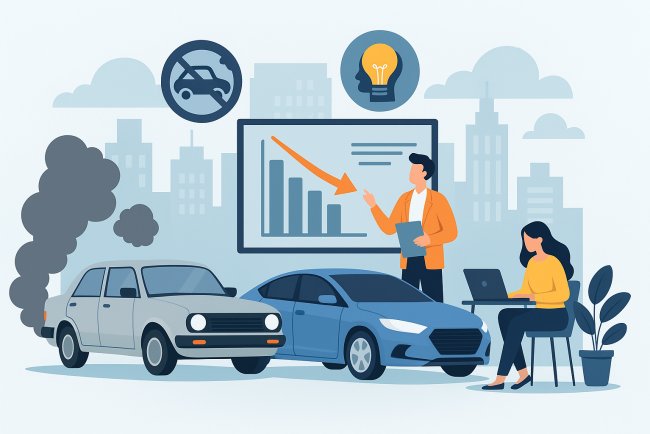
The study showed that there is significantly more pollution caused by traffic lights and stop-start movements than predicted by old traffic models. More waiting time at traffic lights or being in traffic jams causes vehicles to emit more pollutants than those traveling steadily at constant speeds.
Another experiment carried out involved increasing bus travel instead of individual vehicle use, as well as staggering office hours to minimize rush hour traffic. The emission rate declined in both scenarios. The study further indicated that general pollution rates within cities give erroneous information since pollution concentrations are highly variable between roads.
Another important example was the implementation of congestion pricing in certain zones of Manhattan in 2025, which led to a decrease in the volume of traffic by 10% but a drop in pollution by 16-22%, indicating that even slight cuts in car numbers result in substantial reductions in pollutant emissions.
If such an approach be implemented in India, it would help cities understand the sources of pollution and the most effective ways of transportation management. Delhi, Mumbai, Bengaluru, and Hyderabad have faced the problem of traffic jams, long waits for lights to turn green, and heavy pollution caused by cars for quite some time. An automatic system would allow city authorities to detect traffic hotspots, manage traffic flow, modify the timing of lights, encourage the use of public transportation, and establish low-emission zones.
India has many of the necessary infrastructures in place for developing such a framework. Various cities across India have set up CCTVs at junctions through smart city projects. The Smart Cities Mission of the Indian government has helped various cities develop traffic control centres that keep a watch on congestion and movement. Delhi already has initiatives like the Commission for Air Quality Management and pollution tracking from the Central Pollution Control Board, which track air quality data.
Various cities are experimenting with technologies like adaptive traffic signals, bus tracking via GPS, number plate recognition cameras, and congestion tracking. Bengaluru has implemented intelligent traffic management systems that alter the traffic signals depending on the flow of traffic. Meanwhile, Delhi has tested the odd-even formula of restricting vehicles and anti-smog techniques during pollution peaks.
However, if these systems were integrated with mobile movement data and the classification of types of vehicles, Indian urban centres would obtain much more accurate information about the impact of traffic on air pollution. Such an approach could assist the government in making decisions regarding where it needs to construct more metro lines, expand bus routes, restrict access of heavy trucks to specific roads, or introduce electric cars or congestion charges.
The key benefit here lies in the fact that such systems do not involve any construction of new infrastructure, but rather make use of the data that is currently collected through various means, including traffic cameras, mobile phones, GPS units, and air pollution sensors.
What's Your Reaction?